If the Inland Empire was its own country it would be the 125th largest in the world. With over 4.1 million inhabitants, the region (officially the “Riverside–San Bernardino–Ontario Metropolitan Statistical Area”) is larger in population than Uruguay, Armenia, and Kuwait, and slightly smaller than Ireland, New Zealand, and Lebanon.
Category Archives: Inland Empire
Ground Chuck Zero
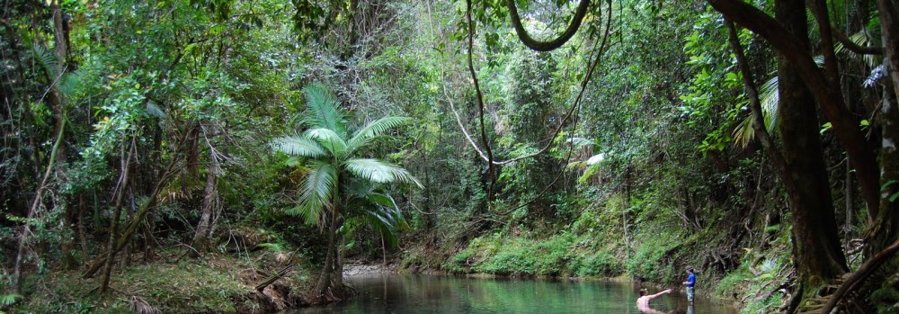
There’s not much of a food scene in the Inland Empire, but the region, and the city of San Bernardino specifically, is at the center of the development of that quintessentially American icon, the fast food restaurant franchise.
There’s a good article by Jerry Daley, “Fast Food’s Ground Zero,” in the current, March 2009, issue of Inland Empire Magazine, unfortunately not online, which touches on the well-known story of how Ray Kroc, a milkshake equipment salesman, was so impressed by the McDonald’s brothers’ hamburger stand in San Bernardino that he approached them about opening more.
IE*: From the bottom of the real estate crater
Housing prices continue to drop like a stone from their absurdly high levels of just a couple of years ago, more here in the Inland Empire than nearly anywhere else in the country. There are some good signs from the market, in a ghoulish kind of way; seventy percent of home sales in the region are for foreclosed properties, which means that the system is still sort of working, and working out some of the pricing problems that have frozen other capital markets. I mean, bad for the people who’ve lost their foreclosed houses, but at least the foreclosure sales are making a market and putting a price on those formerly overvalued assets. There’s still, though, a huge inventory of empty unsold (or unrented; the rental market has cratered, too) properties in the area, with more coming online as projects that were built on spec during the boom are completed. Lots of people are living in houses that are worth less than the mortgage they’re paying on it. If you’ll pardon the awful pun, this is the default position now for homeowners in the Inland Empire.
IE*: A narrow navel band (more on the history of citrus)
In Matt Garcia’s A World of Its Own: Race, Labor, and Citrus in the Making of Greater Los Angeles, 1900-1970 he writes:
Among oranges, Valencias and Washington navels occupied different places in the citrus belt. Since Valencias possessed seeds and were used primarily for juice, farmers cared more about their quantity than quality. Consequently, ranchers grew Valencias near coastal ranges and further down the inland valleys. In the interior, a combination of dry desert breezes, low atmospheric moisture, and the threat of high-elevation frost produced oranges of higher sugar content with a deep reddish-orange hue. Farmers took advantage of such conditions by planting the seedless navel in these districts. Regarded as the sweetest eating-orange and the “autocrat of the price list,” the navel thrived in a narrow belt that extended along the San Gabriel Valley’s inner-mountain foothills from Pasadena to San Bernardino and Redlands.
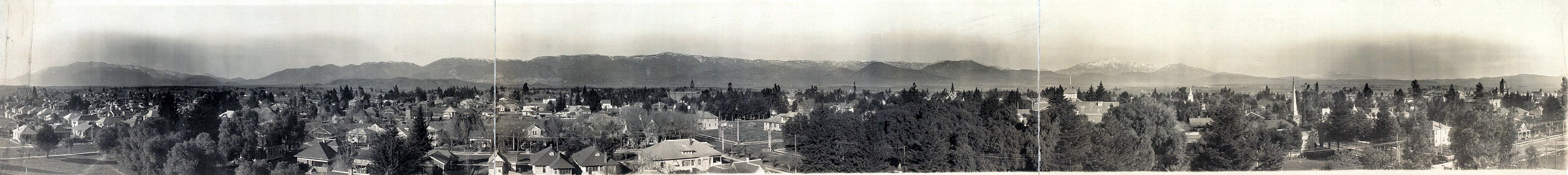
Which is probably common knowledge, but news to me. It helps to explain why the citrus colonies (Pasadena, Arcadia, Monrovia, Pomona, Claremont, Cucamonga, Etiwanda, Alta Loma, Ontario, Fontana, Upland, San Bernardino, Redlands, Riverside to a lesser extent, and probably others) were located where they are: there’s water from the mountains, transport in the form of the new transcontinental railroad, and the right climate for the “autocrat of the price list,” the newly invented (in the mid-nineteenth century) Washington navel orange. But to this list I think you have to add the lure of a healthy California lifestyle, an idea that is older than the place itself.
(By the way, it’s worth noting that the Inland Empire developed independently from Los Angeles; many of the same factors, for sure, were in play, in the growth of both regions, but they are actually fairly distinct. The fact that people commute to LA now makes the IE a distant Los Angeles suburb, which is how I initially understood it. This, however, is a new reality and not productive for understanding the development of the region, which, still, in many ways, is very different from Los Angeles.)
What might be called “the colony mechanism” helped this process along. There were many colonies established in the citrus belt during the crucial 1880 – 1910 period. For example, Pasadena was settled by a group of investors from Indiana, fleeing the cold and looking for a better life, and lifestyle, in the orange groves of southern California. They delegated one of their members to search out the right spot and, like the mother mallard in Make Way for Ducklings, he searched and searched:
San Diego seemed an ideal spot, and the price was right, but a series of windmills would have to be set up to pump water. The Company rejected the idea. Of San Bernardino he said, too hot. Of Anaheim he didn’t care for the superabundance of fleas nor the number of “musketers” (gun toters). Of San Fernando he said, the price at $2 per acre was acceptable, but the area was only good for growing grain. There was too little access to water for citrus growing. The Indianans had their hearts set on orchards. Rancho Santa Anita was the collective lands of today’s Arcadia, Monrovia, Duarte, El Monte, and Baldwin Park. The property had absolutely everything required for citrus growing, but at $20 per acre the place was too expensive.
Eventually he had a good night’s sleep in what was to become Pasadena, although for many years the name of the town was actually the Indiana Colony (quoted above). The Etiwanda Colony — like Upland and the “model colony” of Ontario — was made possible by the Chaffey brothers’ Etiwanda Water Company, bringing water down from the mountains to the productive but dry soil at their base. Likewise, further afield, Anaheim was settled by a group of German-speaking immigrants looking to set up a new life, although for them the lure was grapes for winegrowing rather than oranges. Their first house, and one of the oldest in Orange County, was called the Mother Colony House, now a museum. I’ve heard, but not been able to confirm, that Israeli kibbutzes were at least partly inspired by the citrus colonies, especially Ontario. But I’m not sure that’s true.
|
What’s interesting about this colony mechanism, to me, is that it was not a typical immigrant dynamic. The people in the Indiana Colony, for example, had enough money to invest in a venture that would not bear fruit, if you’ll pardon the pun, for many years. They were not looking to escape oppression or to seek riches; instead, they were looking for a better life, the evergreen promise of the California lifestyle. In the case of the Pasadena settlers, an especially cold Indiana winter motivated them. They came with money and built idealized post-urban communities, often with street names harkening back to Chicago or Indianapolis, so that they could live their supposedly healthy lifestyles amongst their orange groves.
IE*: How conservative is the Inland Empire?
My anecdotal impression is that the Inland Empire is a pretty politically conservative place. So I was surprised that Obama won in the region and I want to look at the issue a bit more closely. Congressional representatives are a good place to start, because they tend to reflect local retail politics most closely, with their constant reelection cycles and small geographic focus. There’s a metric, the Cook Partisan Voting Index (CPVI), that measures how conservative or liberal a congressional district is. Wikipedia explains it thus:
The index for each congressional district is derived by averaging its results from the prior two presidential elections and comparing them to national results. The index indicates which party’s candidate was more successful in that district, as well as the number of percentage points by which its results exceeded the national average. The index is formatted as a letter + number; in a district whose CPVI score is R+2, recent Republican presidential candidates received 2 percentage points more votes than the national average. Likewise, a CPVI score of D+3 shows the Democrats received 3 percentage points more votes than the national average.
So how do the congressional districts of the Inland Empire rank on the CPVI?
Congressional districts don’t align themselves neatly to the borders of the Inland Empire; the region encompasses parts of four congressional districts.
CA-41, where I live, is the most Republican with a CPVI of R+9. It reaches from Redlands all the way out to the Nevada and Arizona borders, making it geographically a very large, although largely unpopulated, district. The long-serving representative, Republican Jerry Lewis, is the head of the powerful House Appropriations Committee.
CA-43, on the other hand, is very strongly Democrat with a CPVI of D+13. This district is in the IE heartland, covering the cities of Ontario, Fontana, Rialto, and San Bernardino. Joe “Cabeza de” Baca, the chair of the Congressional Hispanic Caucus, has been in the House since 1999.
CA-44, covering Riverside, the commercial hub of the region, is Republican with a CPVI of R+6. The district reaches from Norco and Corona all the way down to (non-IE) San Clemente. But the 2008 election, between eight-term incumbent Ken Calvert and Democratic challenger Bill Hedrick, was so close that it still has not yet been decided who actually won, although Calvert has claimed victory.
CA-45 is weakly Republican with a CPVI of R+3. Sonny Bono’s widow, Mary Bono Mack, took over the seat after her husband died in a skiing accident. The district covers the IE communities of Hemet and Moreno Valley but also the Coachella Valley cities of Palm Springs and Indio, which I don’t consider a part of the Inland Empire.
So, based on this limited set of evidence, the picture in the region is more complicated than I had understood. What really stands out is the strongly Democratic 43rd Congressional District; it’s more Democrat, on the CPVI, than any other district is Republican.